Geospatial data is everywhere. Dr. Satish Puri is building new systems to organize it through a distinguished NSF grant.
By Jennifer Walter

Anytime you use a smartphone to navigate, you’re sending and receiving the real-time location data required to get you to your destination. Behind the scenes, savvy algorithms and efficient hardware process the new information every split second, updating traffic reports, road conditions, street closures and more.
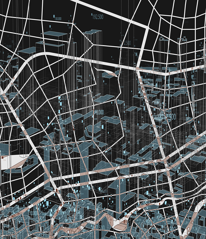
Geospatial data, or information with a location attached to it, is quite literally everywhere. With a growing number of satellites flying over Earth and continuously collecting new data, new information is being amassed exponentially that needs to be processed at breakneck speeds. Dr. Satish Puri, assistant professor of computer science at Marquette, is designing the next generation of systems for geospatial data analysis to help make sense of this glut of information quickly for a variety of applications.

Beyond the navigation apps on your phone, geospatial data can be used to track natural disasters, analyze growing conditions for farmers and survey cities for urban planning projects. Even COVID-19 hotspot maps rely on geospatial analysis to keep track of where cases are rising and falling. “It is a continuously evolving phenomenon as the data gets ingested and hotspots evolve over time and over space,” Puri explains.
In February, Puri received a CAREER grant — a distinguished multiyear award from the National Science Foundation for particularly promising work — to continue his work building systems for more efficient analysis. The award, designed for early career scientists, totals $511,236 and will be distributed in full by 2027. Puri plans to use the funds to continue his research and bring on two graduate students to work in his lab. He will also host workshops to introduce undergraduates to different topics under the geospatial analysis umbrella, including geographic information systems, or GIS.
Puri, whose expertise lies in parallel and distributed computing systems, has been working on problems within geospatial analysis for several years. One of those, which he plans to tackle with the new grant, is load imbalance. It arises when multiple computers are working on a problem to come to a solution together, but the work is not evenly distributed. “Let’s say you have work and you want to divide it among four people,” he explains. “And if the division of work is not equal, then one person will take more time, and the other three could finish faster.”
This disequilibrium can create a lag that holds up the entire system. And when working with real-time geospatial data and large amounts of information that needs to be processed quickly, this shortcoming causes issues with efficiency and performance.
Puri also plans to use a new type of hardware for his research. Data processing units (DPUs) are “a new kid on the block” in the world of computing, Puri says. You may be familiar with central processing units (CPUs) that are the “brains” of ordinary computers, or graphics processing units (GPUs) that handle data-heavy tasks like video gaming and image processing. DPUs are a new class of programmable processor that can handle a combination of different types of processing. They’re typically used in data centers and in supercomputing, but researchers still have work to do if they want to leverage them for use in geospatial analysis.
Over time, Puri’s new systems could open the door to a broader range of applications. In addition, he wants to design faster processing for epidemiological hotspot maps and medical imaging. Once the nuts and bolts of these new systems are in place, the possibilities are endless.
“The techniques are computer science techniques,” Puri says. “But you can apply them in different fields.”